Worth Leaving Town For: Big Four Ice Caves
Recently on Instagram I saw some photos from a friend's day trip to the Big Four Ice Caves and wondered why I hadn't been there yet. Then I realized I had no idea where they even are. The first result I got in Google is from one of my favorite resources, the Washington Trails Association. On their map, I found it on the Mountain Loop Highway, which I was already familiar with from other hikes.
As an early riser, I sometimes arrive a little too early for hikes. Not an issue here. The park is open 24 hours, which is really great after a 70-minute drive. The rendering of the trail near the restrooms showed that I could see everything if I walked to the picnic area first before climbing up the mountain.

The wetlands as seen from the trail to the picnic area // Christopher Bragg
The park is well-kept with a nice variety of terrain: paved trails, wooden bridges, gravel trails, and an impressive metal bridge.

A little bit of everything // Christopher Bragg
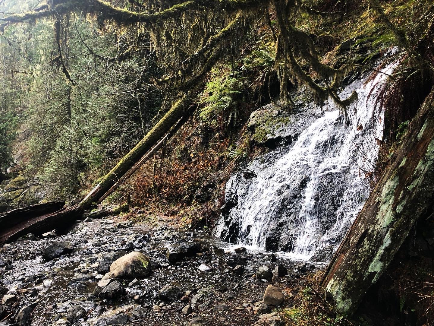
Even though you're ultimately there to see the caves, remember to enjoy the scenery along the way. The Stillaguamish River was especially pretty the day I was there.

Clear and cold // Christopher Bragg
The trail ends at a memorial to Grace Tam, who died in the park at age 11. It's an important reminder that you don't have to enter the caves to be in danger; she was 20 feet away and was killed by falling ice that managed to bounce that far.
Enjoy the view, but keep your distance.

Keep safe by keeping away // Christopher Bragg
Want to explore a little more? On your way back, after the metal bridge connects to the wooden one leading to it, turn around and take this side path.

There's more to see // Christopher Bragg
It leads down to the river, which is a great spot to relax or have a snack.

My whole route was only 3.2 miles, but I climbed 460 feet in that short distance. I hoped to add another short hike on the way back, but couldn't find the trailhead. Here are some tips to help you avoid the same fate:
There's no cell service anywhere near there. Download the region to your phone in Google Maps and save all the places you want to go as starred items. There's no way to search when there's no reception, but with everything saved you can tap and get directions.
Read lots of the trip reports on WTA for places you want to visit. Recent ones let you know what the conditions are likely to be when you get there, while older ones might have vital info. In my case, I didn't know until I got back and read more that I drove right up to the trailhead but didn't spot it.
Each destination's page on WTA lists whether any permits are required with a link to purchase. Big Four Ice Caves requires a Northwest Forest Pass, which you can buy online and print or purchase in person at Big 5 Sporting Goods.
If you forget to buy a pass ahead of time, they're available at the Verlot Public Service Center, which is also the last restroom stop on the route to the park. There are no payment boxes at the park itself due to theft and vandalism.
The Big Four Ice Caves is an interesting destination and a great introduction to the Mountain Loop Highway if you haven't been there before. Explore the area in WTA's hike finder map for more great options in this wonderful region.

Christopher Bragg works from home in Everett and loves walking, swimming, and cats. You can find him all over town, but only if you keep weird hours and avoid crowds like he does.